
Even if you only read this one sentence – the take home message here is that all of our local South Hams estuaries are “rias”.
A ria is just one of nine different types or forms of estuary we find around the coast of the United Kingdom – fjords, fjards and barrier beaches are a few of the others. In fact apart from a few ‘bar-built’ estuaries, such as the Exe Estuary, all around the South West are ria type estuaries.
Before we explore what this means, we should just check that we are on the same page with what an estuary is.
An estuary is the final length of a river where its freshwaters meet and importantly mix with the saltwater of the ocean.

-Cleared-for-use-by.jpeg?width=209&height=140&crop=209:145,smart&quality=75)
It shouldn’t really therefore surprise us that there are some 155 estuaries listed in the “Nature Conservation and Estuaries in Great Britain” book.
As they are by definition tidal, the area where this freshwater mixes with the saltwater moves up and down the estuary with each tide.
Add the exposure of the intertidal areas at low tide to whatever the weather is throwing at it at that moment and estuaries can be a very challenging place for wildlife to live.
This is what I find so exciting and interesting about estuaries, just how that wildlife survives, adapts or migrates within these challenging conditions.
Back to rias, they are essentially deep river-cut valleys that were carved out by the energy of the raging torrents of rivers flowing down across the country during the last Ice Age, or possibly ice ages.
These deep river valleys have then flooded as the sea level rose a massive 120m between Ice Age max and its end.
(There could also be some tectonic subsidence as part of the UK’s mainland seesaw action as northern Britain “bounced-back” after the ice melted.)
Rias are consequently also known as “drowned river valleys”.
If you are lucky enough to get sight of a chart showing the topography of the seabed off our coast, you can still pick out some of these drowned river valleys under the sea – the Erme Estuary probably being clearest for this.
It is believed that during the last Ice Age, the River Dart flowed down across a plain that is now Start Bay and met the ocean then somewhere out past Start Point … presumably through an estuary now over 100m deep below the English Channel!
And thinking that through, that estuary must have gradually worked back up the river as the Ice Age waned and the sea level rose to where we are today.
Our South Hams coast also shows examples of “wave cut platforms” from periods of our planet’s history when sea levels were higher than today, so the estuaries then would have be further ‘inland’, as we see it today.
Beyond their common formation, each of our lovely and special estuaries are really quite different in nature – a complex mix and balance of everything from their rainwater catchment areas and flow of the rivers, to their geology and how we use, enjoy, love and possibly abuse them. Our two local neighbouring estuaries of the
Dart and Salcombe-Kingsbridge, as an example, could hardly be more different in nature.
The Dart Estuary is a relatively long and narrow estuary, with few smaller tributaries, and with a quite significant water catchment area that captures the rain as far up as Dartmoor … not known for its dry weather!
Thus, the Dart’s is a very freshwater dominated estuary and during high rainfall events the surface water flowing out past its mouth can sometimes still be freshwater.
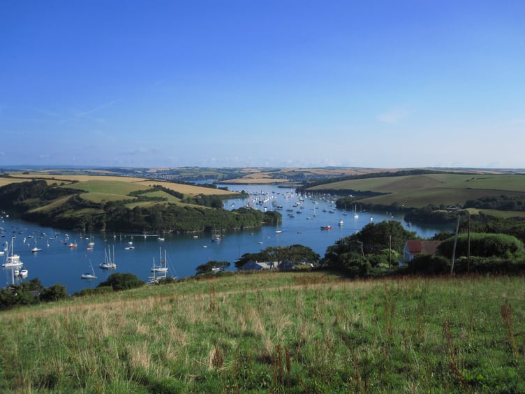
The Salcombe-Kingsbridge Estuary on the other hand has many larger creeks, each of which might be a “drowned river valley” in their own right, that join and drain through a larger single channel.
This estuary is the classic example of a “drendritic ria” estuary, multi-fingered like a giant hand. It also has a much smaller water catchment area so that for the most part, it is a very saltwater dominated estuary. In many ways it is more of a sheltered marine inlet and consequently supports much more of a marine diversity of wildlife, that is arguably less able to survive the harsher conditions of the Dart.
The Yealm, Erme and Avon Estuaries are all somewhere between the extremes of the Dart and Salcombe-Kingsbridge and might be described as more typical estuaries … but each in no way less special or beautiful.
Comments
This article has no comments yet. Be the first to leave a comment.